Interactive Image Maps
Overview
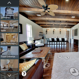
Depict major structural elements of your building project, design, and architectural details with CartoBlue’s interactive image maps. Image maps can be created for single homes, condominium complexes, commercial properties, and more. Labels and photos can be added to the exterior elevation to make it interactive and to give viewers a glimpse of the interior. These interactive image maps are a great tool for any pre-construction building project or existing structure.
Contact CartoBlue for a consultation. Our project team will work with you to identify your full requirements and provide specific pricing. We will create an interactive image map for your property or project and guide you on how to add it to your website and marketing materials.
Features
Other Products
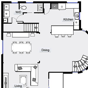 Interactive Floor Plans
Learn more
Interactive Floor Plans
Interactive Floor Plans
Learn more
Interactive Floor Plans
 Interactive Image Maps
Learn more
Interactive Image Maps
Interactive Image Maps
Learn more
Interactive Image Maps
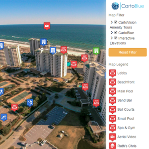
 CartoVision
Learn more
CartoVision
CartoVision
Learn more
CartoVision
 3D Animated Tours
Learn more
3D Animated Tours
3D Animated Tours
Learn more
3D Animated Tours
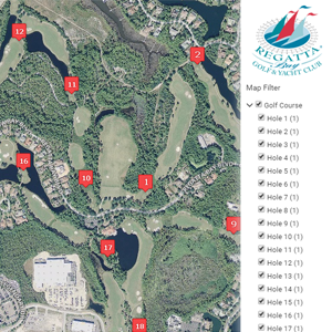 Interactive Golf Course
Learn more
Interactive Golf Course
Interactive Golf Course
Learn more
Interactive Golf Course
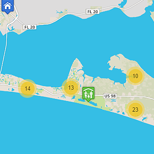 Interactive Maps
Learn more
Interactive Maps
Interactive Maps
Learn more
Interactive Maps
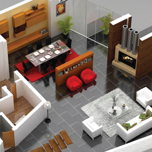 3D Floor Plans
Learn more
3D Floor Plans
3D Floor Plans
Learn more
3D Floor Plans
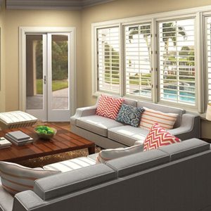 Renderings
Learn more
Renderings
Renderings
Learn more
Renderings
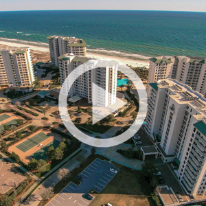 Drone Videography
Learn more
Drone Videography
Drone Videography
Learn more
Drone Videography
 google-tours
Learn more
google-tours
google-tours
Learn more
google-tours