Vacation Rentals | Interactive Maps
Get Started Today With Our Interactive Maps!
Customize the maps with your own content.
Integrate with your Vacation Rental or Real Estate Property Listings!
Overview
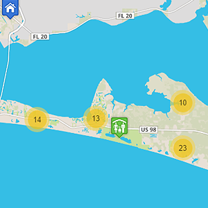
Area maps from CartoBlue are illustrative portrayals of a designated geographic area. Popularly used in the hospitality industry to showcase the surrounding area, area maps show clients what to expect when they arrive and help them navigate their way to nearby attractions. Real estate agents and developers also use the area maps to display multiple for-sale properties within a specific area. The maps can be synced with MLS listings to view all listed properties at their geographic location. In fact, the maps can be synced to update automatically with MLS listings, your API, or PMS. They’re also incredibly easy to add onto your website. CartoBlue will provide you with a unique URL and an iframe code to add to your website.
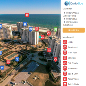
Use an area map to give your guests and clients a wider perspective of your area. With interactive features, you can imbed photos and add markers to important locations like grocery stores, restaurants, and shopping malls. Giving your clients more information about the area is a win-win situation. With more information, clients have more confidence to rent or buy the property. You’re not only providing them with information, but also with detailed visuals that prompt them to envision themselves experiencing the area.
Features
Other Products
 google-tours
Learn more
google-tours
google-tours
Learn more
google-tours
 Interactive Image Maps
Learn more
Interactive Image Maps
Interactive Image Maps
Learn more
Interactive Image Maps
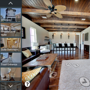
 Interactive Maps
Learn more
Interactive Maps
Interactive Maps
Learn more
Interactive Maps
 3D Animated Tours
Learn more
3D Animated Tours
3D Animated Tours
Learn more
3D Animated Tours
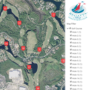 Interactive Golf Course
Learn more
Interactive Golf Course
Interactive Golf Course
Learn more
Interactive Golf Course
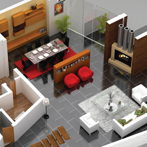 3D Floor Plans
Learn more
3D Floor Plans
3D Floor Plans
Learn more
3D Floor Plans
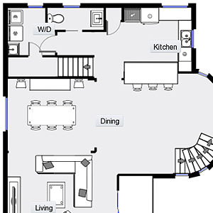 Interactive Floor Plans
Learn more
Interactive Floor Plans
Interactive Floor Plans
Learn more
Interactive Floor Plans
 Renderings
Learn more
Renderings
Renderings
Learn more
Renderings
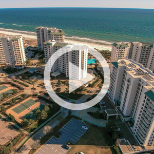 Drone Videography
Learn more
Drone Videography
Drone Videography
Learn more
Drone Videography
 CartoVision
Learn more
CartoVision
CartoVision
Learn more
CartoVision